Chronicle
The castle stands at about 210 m above sea level on the south-facing slope of the Neckar valley, between Binau and Obrigheim, above the B 37 road. Its rock is not part of the hills: it is calcareous tufa, deposited by a strongly lime-rich, copiously flowing spring — stone that has precipitated out of water. In the Neckar valley it is a foreign body. Ludwig H. Hildebrandt describes the medieval sight as a castle on a white rock of a kind the Neckar valley does not otherwise know. Hence, probably, the name: Tahenstein, Tugstein, Duckstein, Dauchstein, in modern German Tuffstein, tufa. Legend derives it differently, from a toll chain across the Neckar that was only lowered — “gedaucht” — once payment had been made. The tower itself is built of Bunter sandstone (Buntsandstein); in 2024 the Denkmalstiftung described its walls as unrendered and about 1.70 m thick. Whether tufa was used anywhere else on the site — Naeher noted tufa masonry in 1893, Hildebrandt adds a question mark — is as unproven as the origin of the sandstone.
Around 1080/90 a nobleman, Kuno von Tahenstein, appears a single time, in a donation to Reichenbach Abbey. The common dating of the castle to the 11th or 12th century rests on him; Wikipedia gives “around 1030”. After that the sources fall silent for some 250 years. A scaffolding timber from the lower storey of the tower has been dated by dendrochronology to the winter of 1334/35: the tower and the remnant of the shield wall were built around 1335. Hildebrandt concludes that there were two castles on the same site with no connection between them. No fabric of the first one is known; the Denkmalstiftung considers it possible that its walls disappeared as the tufa was quarried away.
In January 1330 Emperor Ludwig pledged the Mosbach Zent to the Counts Palatine of the Rhine, bringing Binau under the rule of the Electoral Palatinate. Hildebrandt sees the tower as a toll castle, built on the orders of the Counts Palatine to secure their new rights on the river. The Denkmalstiftung, on the other hand, attributes it to Baldwin of Luxembourg, Archbishop of Trier, without citing evidence. From 1343/44 Konrad and Heinrich von Bynheim can be traced, a family of lesser nobility that took its name from Binau. From 1398 the lords of Helmstatt held the Dauchstein; the now ruined residential range is attributed to them. In 1448 they sold to Dieter von Bödigheim. In 1538 Georg von Bödigheim called the dwelling there “fast schlecht” — in the usage of the time: very poor. In the second half of the 16th century Binau passed by marriage to the Landschaden von Steinach, who presumably built themselves a new seat in the village. The castle was no longer lived in, the residential range decayed, and a small watchman’s house was built from its remains; in 1676 the lower storey of the tower is recorded as a prison. In 1629 Binau and the Dauchstein went to the lords of Hunoltstein, and ownership changed several times after that.
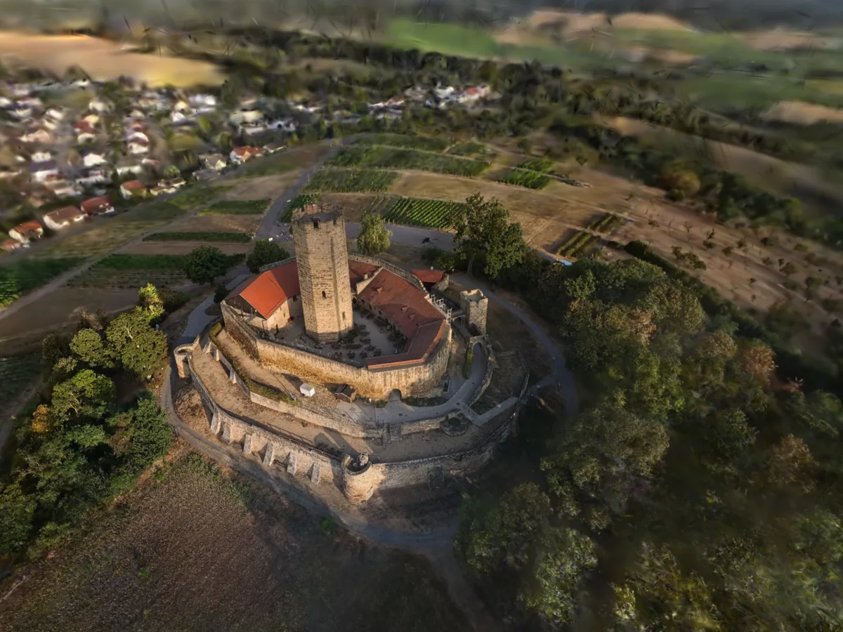
The residential tower measures six by six metres and was originally about 20 m tall. Two features stand out: the latrine lay inside, with a drain pipe to the outside, and the storeys are not linked by wooden stairs or ladders but by a narrow, low stair passage within the wall, at its tightest little more than half a metre wide. In the 1960s the tower faced demolition as unsafe. The State Office for Monument Preservation insisted on saving it; students from Heidelberg and a local master builder secured the tower and its grounds and fitted out the rooms, and the municipality laid out a new access path. The timber top storey with its pointed roof was added at the same time, bringing the tower to about 25 m today. It is privately owned and has been made habitable; the footpath leads across the courtyard, and the site can be seen from outside at any time. Roof and joints were most recently repaired with funding from the Denkmalstiftung Baden-Württemberg, which named the castle its Monument of the Month in January 2025.
Opposite, on the other bank, stands the Obrigheim nuclear power station: built from 1965, in operation from 1969, shut down in May 2005 and being dismantled ever since. The rock the castle is named after could, according to Hildebrandt, be brought back into view: it would have to be cleared and the spring water led over it again. The scan shows the tower in its autumn foliage: the dark red board-clad timber storey, the covered outside stair, the shutters in yellow and red, the colours of Baden, and in front of the tower a roofless square of walls. From above, the main road and the Neckar lie below.
Sources
- Burg Dauchstein — Szene auf superspl.at ↗
- Burg Dauchstein — Wikipedia (deutsch) ↗
- Burg Dauchstein — Ludwig H. Hildebrandt, Neue Erkenntnisse über die Burg Dauchstein bei Binau, in Kraichgau 19 (2005), S. 151–162 ↗
- Burg Dauchstein — Denkmalstimme 1/2024, Denkmalstiftung Baden-Württemberg ↗
- Burg Dauchstein — Burgenarchiv.de ↗